Файл:Nicobar Islands.jpg
Няма вэрсіі зь лепшым разрозьненьнем.
Nicobar_Islands.jpg (643 × 564 піксэлі, памер файла: 70 кб, тып MIME: image/jpeg)
|
|
Гэты файл паходзіць зь Вікісховішча. Зьвесткі пра гэты файл зь яго старонкі апісаньня прыведзеныя ніжэй. Вікісховішча — сховішча вольных мэдыяфайлаў. Вы можаце дапамагчы. |
Апісаньне
| Апісаньне |
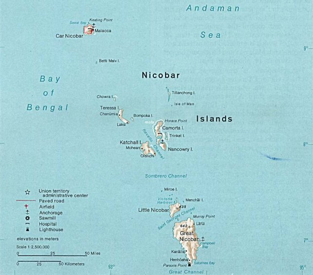
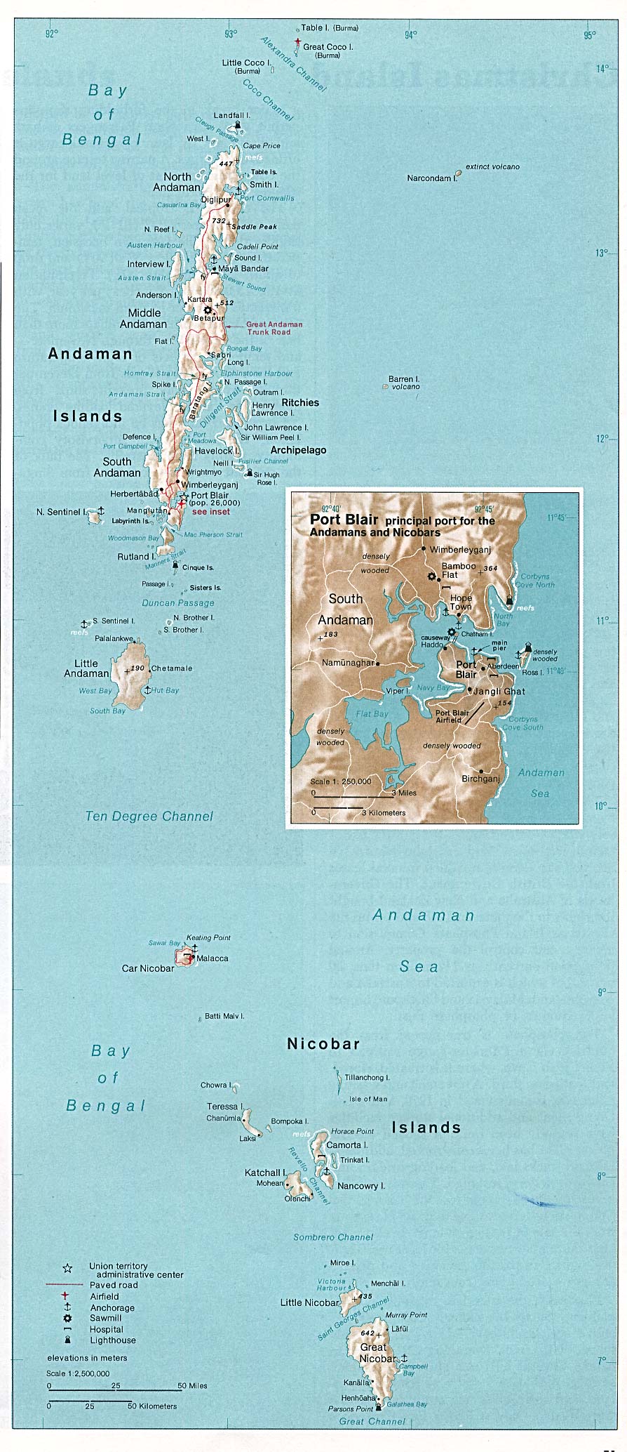
Deutsch: Karte der Inselgruppe der Nikobaren im Indischen Ozean
English: Map of the Nicobar Island in the Indian Ocean
Français : Carte d’îles Nicobar dans l’océan Indien |
| Дата | |
| Крыніца | http://www.lib.utexas.edu/maps/islands_oceans_poles/andaman_nicobar_76.jpg |
| Аўтар | Taken from Perry-Castañeda Library (PCL), originally from CIA Indian Ocean Atlas |
| Іншыя вэрсіі |
Ліцэнзія
| This image is a work of a Central Intelligence Agency employee, taken or made as part of that person's official duties. As a Work of the United States Government, this image or media is in the public domain in the United States.
|

|
Гісторыя файла
Націсьніце на дату/час, каб паглядзець, як тады выглядаў файл.
| Дата і час | Мініятура | Памеры | Удзельнік | Камэнтар | |
|---|---|---|---|---|---|
| цяперашняя | 01:33, 15 траўня 2005 | | 643 × 564 (70 кб) | Jeroen | From the Indian Ocean Atlas, published by the Central Intelligence Agency, 1976. From en:Image:Nicobar_Islands.jpg ''This image is a work of a Central Intelligence Agency employee, taken or made during the course of the person's official duties. As |
Выкарыстаньне файла
Наступная старонка выкарыстоўвае гэты файл:
Глябальнае выкарыстаньне файла
Гэты файл выкарыстоўваецца ў наступных вікі:
- Выкарыстаньне ў ace.wikipedia.org
- Выкарыстаньне ў ar.wikipedia.org
- Выкарыстаньне ў arz.wikipedia.org
- Выкарыстаньне ў az.wikipedia.org
- Выкарыстаньне ў bg.wikipedia.org
- Выкарыстаньне ў bn.wikipedia.org
- Выкарыстаньне ў br.wikipedia.org
- Выкарыстаньне ў ca.wikipedia.org
- Выкарыстаньне ў ceb.wikipedia.org
- Выкарыстаньне ў cs.wikipedia.org
- Выкарыстаньне ў da.wikipedia.org
- Выкарыстаньне ў de.wikipedia.org
- Выкарыстаньне ў en.wikipedia.org
- Выкарыстаньне ў eo.wikipedia.org
- Выкарыстаньне ў es.wikipedia.org
- Выкарыстаньне ў eu.wikipedia.org
- Выкарыстаньне ў fa.wikipedia.org
- Выкарыстаньне ў fi.wikipedia.org
- Выкарыстаньне ў fi.wiktionary.org
- Выкарыстаньне ў fr.wikipedia.org
- Выкарыстаньне ў fr.wikinews.org
- Выкарыстаньне ў gl.wikipedia.org
- Выкарыстаньне ў gu.wikipedia.org
- Выкарыстаньне ў hi.wikipedia.org
- Выкарыстаньне ў id.wikipedia.org
- Выкарыстаньне ў ilo.wikipedia.org
- Выкарыстаньне ў it.wikipedia.org
- Выкарыстаньне ў ja.wikipedia.org
- Выкарыстаньне ў ka.wikipedia.org
- Выкарыстаньне ў ko.wikipedia.org
Паказаць глябальнае выкарыстаньне гэтага файла.